Place de la Bastille

Revealed: What the future Place de la Bastille will look like

Share this article

Revealed: What the future Place de la Bastille will look like
Photos: IN Suta
Plans have been unveiled for how the iconic Place de la Bastille in Paris will look after a major makeover.

From spring next year work will begin to transform the historic Place de la Bastille in Paris.

Last week Mayor Anne Hidalgo rubber stamped the plans that will see a major makeover of one of the city’s most iconic spots.

The mayor’s plan is to make the square more pedestrian friendly rather than it just being a huge roundabout permanently clogged with traffic, as it is currently.

Under the revamp the roundabout will go and cars will travel in two directions around three sides of the square.

Around half of the whole area will be pedestrianized with the stand-out feature being the creation of new access from the square down to the picturesque Bassin de L’Arsenal where many small boats are moored.

A new stairway will be built from the square down to the canal below, passing under the bridge that carries trains on Metro line 1.

“We really wanted pedestrians to have direct access to the canal, but we were working on how to get there.  Then planners came up with this great idea, and we had it priced. We can assume it will be both spectacular and respectful of heritage,” said Anne Hidalgo.

Around 50 trees will be planted around the square and the famous Paris cobbles will be stripped from the road and replaced with a new surface in order to reduce the noise from traffic.

Authorities also want to acknowledge the historic significance of the square, where revolutionaries stormed the prisons on July 14 1789 in what was seen as the most symbolic act of the French revolution.

A quote from the French philosopher Alexis de Tocqueville will be engraved on the square. It will read: “Les Français ont fait en 1789 le plus grand effort auquel se soit jamais livré aucun peuple”. (Roughly: “In 1789 the French made the most resolute effort by any nation.”)

And the the Colonne de Juillet, this monument n the middle of the roundabout will reopen to the public.

Built in 1835 in memory of the victims of the 1830 July Revolution, the colonne The Colonne de Juillet actually houses two large tombs which contain the remains of between 500 and 700 revolutionaries who died in the uprisings of 1830 and 1848.The plans ave been put together by architects Bernard Althabegoīty and Annick Bayle.

A public meeting will be held in December with residents to discuss the plans, with works to take place between April 2018 and Summer 2019.

The plans to revamp Bastille are part of a €44 million project to give seven historic squares a makeover including Place de l’Italie and Place de la Nation.

Hidalgo’s aim is to return the squares to pedestrians as she continues her war on cars that has seen her pedestrianise part of the right bank of the Seine, much to the anger of motorists and ban the most polluting cars from the city centre.

READ ALSO: Paris gives green light for revamp of historic squares

Paris gives green light for revamp of historic squares


Archaeological site – Saint-Lupien in Rezé

The following content has been translated and adapted from the original work by lefildeculture in In the Estuary  25/07/2014.

Saint-Lupien in Rezé is one of the most important archaeological sites in this region. Recognized on a European scale, it is has been the object of programmed excavations and every year from June to July groups of 50 or so people have worked on exhumation of the Gallo-Roman remains. To explain the discoveries and the history of the city, a heritage interpretation and animation center (CIAP), or simply the Chronographe, has been constructed.

Rezé is a commune and former bishopric in the Loire-Atlantique department in the Pays de la Loire region of western France (Britanny or Bretagne prior to 1789). It was named Ratiatum by the Roman settlers in the 1st and 2nd centuries AD, Ratiate in the Middle Ages and Rezay in the High Middle Ages. Inhabitants of Rezé are called Rezéens.

Archaeological excavations of Saint-Lupien

The first Gallo-Roman ruins in Saint-Lupien were excavated in the 19th century but it was especially during the construction of a subdivision in the 1980s that the City became aware of the size of the site and acquired the ground to protect it. In 2004, an archaeological service is created. Since then, planned excavations have been coordinated by the Inrap (National Institute of Archaeological Research), the City of Rezé and the University of Nantes and the Chronographe is the result of these studies, a presentation of the site which provides a viewing platform to better survey the remains and visualise the original site.


The history : the ancient city of Ratiatum

During the Roman conquest, independent tribes shared the Gallic territory. North of the Loire, the Namnetes founded the city of Condevicnum, future city of Nantes. In 56 BC, the Venetians, a people of the Armorican region, resisted. In order to defeat them, Caesar allied with Pictons, whose capital is Limonum (Poitiers), which provides him with wood, soldiers and ships. The Venetes are then defeated. It is possible that in the form of a reward, the Pictons could expand their territory to the Loire. They then founded Ratiatum, the future town of Rezé, which stretches for two kilometers along the banks and 500 meters deep inland. It does not seem like much today, but it was an important agglomeration. It was cited by geographers of the time, Strabo and Ptolemy.

The remains of the ancient quay

The strategic position of Ratiatum made it the ideal place to establish a port to promote trade, especially with the Namnètes, neighbors of the north of the Loire. Ceramics, now preserved in the departmental museum Thomas Dobré (closed for renovation), testify to exchanges with provinces sometimes very far away, for example the Palestinian region. In 2011, remains of monumental docks were discovered. This is an exceptional case in France, which indicates the wealth of the ancient city of Ratiatum.


 Digital reconstruction of the facilities of the Gallo-Roman port


These terraced wharves advanced into the river, connected by bank walls. Composed of oak beams and micaschist fragments, their state of preservation is exceptional. On the front, a series of posts at regular intervals are fixed by mortise and tenon on a sandpit (a large horizontal beam). These woods have inscriptions: Roman numerals that served as benchmarks for the assembly. Dating from dendrochronology, using growth rings of trees, it is established that these poles come from oaks felled in the winter of 88-89 AD.


The monumental docks in front of the Saint-Lupien Chapel


In the photograph, the beams are covered with a geotextile veil to keep them in a damp environment and away from light. Near the docks were warehouses, workshops and shops, following a typical checkered pattern of Roman cities. At the end of the second century AD, the port began to decline. Scientists do not have the explanation yet. Several hypotheses are formulated, including that of a silting of the Loire at this location, making the port of Ratiatum obsolete. Today, the banks of the Loire are 500 meters from the site.


The archeological millefeuille of Saint-Lupien Chapel

The chapel Saint-Lupien is an archeological millefeuille because it contains vestiges of all eras. Two large Gallo-Roman walls intersect at right angles. They lined the street that overlooked the wharf.


Gallo-Roman remains located under the chapel


In the Middle Ages, the site becomes a center of pilgrimage around the tomb of one of the first Christians of Rezé: Saint Lupien. Until the twelfth century, a necropolis with different types of burials occupies the site. Sarcophagi are used for the foundations of the first chapel, built in the 9th century.


Sarcophagi and bones in the foundations of the first chapel


Sarcophagus with carved head

In the fourteenth century, a new chapel that corresponded to the current plan was erected. Until the eighteenth century, it belonged to the priory of Geneston Abbey. Sold at the Revolution, the chapel Saint-Lupien became a place of storage of hay, adjoining a farm. In the nineteenth century, the owner of the farm discovered bones that he believed belong to Saint Lupien himself and built a vault. At the same time, the walls were raised and a new frame installed.

The archaeological site of Saint-Lupien continues to unveil new secrets. Villas, workshops, thermal baths, a small temple, a main street with porticoes, warehouses and monumental docks make up the ancient port district of Ratiatum, on the site of the current Saint-Lupien area. In the Middle Ages, the use of some buildings for the necropolis allowed a conservation of the foundations which gives much information on the Gallo-Roman life but also on the evolution of the site. Today, the City of Rezé wishes to highlight this heritage and make the Saint-Lupien site a cultural and tourist center at the local and national levels.


Click Refresh to view slides


Paris Railways and Stations

Intercity Paris Stations – National


Paris Metro

Plan-Metro


Paris Metro website


Paris and outer suburbs

RER/Metro

Plan-RER-et-transiliens


Link for summary of all stations showing line numbers and photos


Paris and outer suburbs

Bus


Plan-des-Bus


History

During the initial construction of the Métro, the tunnels were excavated in open sites and then covered.

Bastille station at the beginning of the 20th century

By 1845, Paris and the railway companies were already thinking about an urban railway system to link inner districts of the city. The railway companies and the French government wanted to extend main-line railroads into a new underground network, whereas the Parisians favoured a new and independent network and feared national takeover of any system it built.[9] The disagreement lasted from 1856 to 1890. Meanwhile, the population became more dense and traffic congestion grew massively. The deadlock put pressure on the authorities and gave the city the chance to enforce its vision.

Prior to 1845, the urban transport network consisted primarily of a large number of omnibus lines, consolidated by the French government into a regulated system with fixed and unconflicting routes and schedules.[10] The first concrete proposal for an urban rail system in Paris was put forward by civil engineer Florence de Kérizouet. This plan called for a surface cable car system.[11] In 1855, civil engineers Edouard Brame and Eugène Flachat proposed an underground freight urban railroad, due to the high rate of accidents on surface rail lines.[11] On 19 November 1871 the General Council of the Seine commissioned a team of 40 engineers to plan an urban rail network.[12] This team proposed a network with a pattern of routes “resembling a cross enclosed in a circle” with axial routes following large boulevards. On 11 May 1872 the Council endorsed the plan, but the French government turned down the plan.[12] After this point, a serious debate occurred over whether the new system should consist of elevated lines or of mostly underground lines; this debate involved numerous parties in France, including Victor Hugo, Guy de Maupassant, and the Eiffel Society of Gustave Eiffel, and continued until 1892.[13] Eventually the underground option emerged as the preferred solution because of the high cost of buying land for rights-of-way in central Paris required for elevated lines, estimated at 70,000 francs per metre of line for a 20-metre-wide railroad.[14]

The last remaining hurdle was the city’s concern about national interference in its urban rail system. The city commissioned renowned engineer Jean-Baptiste Berlier, who designed Paris’ postal network of pneumatic tubes, to design and plan its rail system in the early 1890s.[14] Berlier recommended a special track gauge of 1,300 mm (4 ft 3 316 in) (versus the standard gauge of 1,435 mm or 4 ft 8 12 in) to protect the system from national takeover, which inflamed the issue substantially.[15] The issue was finally settled when the Minister of Public Works begrudgingly recognized the city’s right to build a local system on 22 November 1895, and by the city’s secret designing of the trains and tunnels to be too narrow for main-line trains, while adopting standard gauge as a compromise with the state.[15]

Fulgence Bienvenüe project

Construction of Chevaleret station, 1903

Line 2 near Jaurès station

On 20 April 1896, Paris adopted the Fulgence Bienvenüe project, which was to serve only the city proper of Paris. Many Parisians worried that extending lines to industrial suburbs would reduce the safety of the city. Paris forbade lines to the inner suburbs and, as a guarantee, Métro trains were to run on the right, as opposed to existing suburban lines, which ran on the left.

Unlike many other subway systems (such as that of London), this system was designed from the outset as a system of (initially) nine lines.[16] Such a large project required a private-public arrangement right from the outset – the city would build most of the permanent way, while a private concessionaire company would supply the trains and power stations, and lease the system (each line separately, for initially 39-year leases).[further explanation needed][16] In July 1897, six bidders competed, and The Compagnie Generale de Traction, owned by the Belgian Baron Édouard Empain, won the contract; this company was then immediately reorganized as the Compagnie de Chemin de Fer Metropolitan.[16]

Construction began on November 1898.[17] The first line, Porte MaillotPorte de Vincennes, was inaugurated on 19 July 1900 during the Paris World’s Fair. Entrances to stations were designed in Art Nouveau style by Hector Guimard. Eighty-six of his entrances are still in existence.

Bienvenüe’s project consisted of 10 lines, which correspond to today’s Lines 1 to 9. Construction was so intense that by 1920, despite a few changes from schedule, most lines had been completed. The shield method of construction was rejected in favor of the cut-and-cover method in order to speed up work.[18] Bienvenüe, a highly regarded engineer, designed a special procedure of building the tunnels to allow the swift repaving of roads, and is credited with a largely swift and relatively uneventful construction through the difficult and heterogeneous soils and rocks.[19]

Lines 1 and 4 were conceived as central east-west and north-south lines. Two lines, ligne 2 Nord (line 2 North) and ligne 2 Sud (line 2 South), were also planned but line 2 South was merged with line 5 in 1906. Line 3 was an additional east-west line to the north of line 1 and line 5 an additional north-south line to the east of line 4. Line 6 would run from Nation to Place d’Italie. Lines 7, 8 and 9 would connect commercial and office districts around the Opéra to residential areas in the north-east and the south-west. Bienvenüe also planned a circular line, the ligne circulaire intérieure, to connect the six main-line stations. A section opened in 1923 between Invalides and the Boulevard Saint-Germain before the plan was abandoned.

Nord-Sud competing network

A Nord-Sud station signage

On 31 January 1904, a second concession was granted to the Société du chemin de fer électrique souterrain Nord-Sud de Paris (Paris North-South underground electrical railway company), abbreviated to the Nord-Sud (North-South) company. It was responsible for building three proposed lines:

  • line A would join Montmartre to Montparnasse as an additional north-south line to the west of Line 4.
  • line B would serve the north-west of Paris by connecting Saint-Lazare station to Porte de Clichy and Porte de Saint-Ouen.
  • line C would serve the south-west by connecting Montparnasse station to Porte de Vanves. The aim was to connect B with C, but CMP bought before: B renamed 13, C 14. Both were connected by RATP as current Line 13.

Line A was inaugurated on 4 November 1910, after being postponed because of floods in January that year. Line B was inaugurated on 26 February 1911. Because of the high construction costs, the construction of line C was postponed. Nord-Sud and CMP used compatible trains that could be used on both networks, but CMP trains used 600 volts third rail, and NS −600 volts overhead wire and +600 volts third rail. This was necessary because of steep gradients on NS lines. NS distinguished itself from its competitor with the high-quality decoration of its stations, the trains’ extreme comfort and pretty lighting.

Nord-Sud did not become profitable and bankruptcy became unavoidable. By the end of 1930, the CMP bought Nord-Sud. Line A became Line 12 and line B Line 13. Line C was built and renamed line 14, that Line was reorganized in 1937 with Lines 8 and 10. This partial line is now the south part of line 13.

The last Nord-Sud train set was decommissioned on 15 May 1972.[20]

1930–1950: first inner suburbs are reached

Paris Métro network in 1939

Bienvenüe’s project was nearly completed during the 1920s. Paris planned three new lines and extensions of most lines to the inner suburbs, despite the reluctance of Parisians. Bienvenüe’s inner circular line having been abandoned, the already-built portion between Duroc and Odéon for the creation of a new east-west line that became line 10, extended west to Porte de Saint-Cloud and the inner suburbs of Boulogne.

The line C planned by Nord-Sud between Montparnasse station and Porte de Vanves was built as line 14 (different from present line 14). It extended north in encompassing the already-built portion between Invalides and Duroc, initially planned as part of the inner circular. The over-busy Belleville funicular tramway would be replaced by a new line, line 11, extended to Châtelet. Lines 10, 11 and 14 were thus the three new lines envisaged under this plan.

Most lines would be extended to the inner suburbs. The first to leave the city proper was line 9, extended in 1934 to Boulogne-Billancourt; more followed in the 1930s. World War II forced authorities to abandon projects such as the extension of Lines 4 or 12 to the northern suburbs. By 1949, eight lines had been extended: Line 1 to Neuilly-sur-Seine and Vincennes, Line 3 to Levallois-Perret, Line 5 to Pantin, Line 7 to Ivry-sur-Seine, Line 8 to Charenton, Line 9 to Boulogne-Billancourt, Line 11 to Les Lilas and Line 12 to Issy-les-Moulineaux.

World War II had a massive impact on the Métro. Services were limited and many stations closed. The risk of bombing meant the service between Place d’Italie and Étoile was transferred from Line 5 to line 6, so that most of the elevated portions of the Métro would be on Line 6. As a result, Lines 2 and 6 now form a circle. Most stations were too shallow to be used as bomb shelters. The French Resistance used the tunnels to conduct swift assaults throughout Paris.[21]

It took a long time to recover after liberation in 1944. Many stations had not reopened by the 1960s and some closed for good. On 23 March 1948, the CMP (the underground) and the STCRP (bus and tramways) merged to form the RATP, which still operates the Métro.

1960–1990: development of the RER

Line 5’s Viaduc d’Austerlitz, crossing the river Seine

The network grew saturated during the 1950s. Outdated technology limited the number of trains, which led the RATP to stop extending lines and concentrate on modernisation. The MP 51 prototype was built, testing both rubber-tyred metro and basic automatic driving on the voie navette. The first replacements of the older Sprague trains began with experimental articulated trains and then with mainstream rubber-tyred metro MP 55 and MP 59, some of the latter still in service (line 11). Thanks to newer trains and better signalling, trains ran more frequently.

The population boomed from 1950 to 1980. Cars became more popular and suburbs grew further from the city. The main railway stations, termini of the suburban rail lines, were overcrowded during rush hour. The short distance between metro stations slowed the network and made it unprofitable to build extensions. The solution in the 1960s was to revive a project abandoned at the end of the 19th century: joining suburban lines to new underground portions in the city centre as the Réseau express régional (regional express network; RER).

The RER plan initially included one east-west line and two north-south lines. RATP bought two unprofitable SNCF lines—the Ligne de Saint-Germain (westbound) and the Ligne de Vincennes (eastbound) with the intention of joining them and to serve multiple districts of central Paris with new underground stations. The new line created by this merger became line A. The Ligne de Sceaux, which served the southern suburbs and was bought by the CMP in the 1930s, would be extended north to merge with a line of the SNCF and reach the new Charles de Gaulle Airport in Roissy. This became line B. These new lines were inaugurated in 1977 and their wild success outperformed all the most optimistic forecasts to the extent that line A is the most used urban rail line in the world with nearly 300 million journeys a year.

Because of the enormous cost of these two lines, the third planned line was abandoned and the authorities decided that later developments of the RER network would be more cheaply developed by SNCF, alongside its continued management of other suburban lines. However, the RER developed by SNCF would never match the success of the RATP’s two RER lines. In 1979, SNCF developed line C by joining the suburban lines of Gare d’Austerlitz and Gare d’Orsay, the latter being converted into a museum dedicated to impressionist paintings. During the 1980s, it developed line D, which was the second line planned by the initial RER schedule, but serving Châtelet instead of République to reduce costs. A huge Métro-RER hub was created at Châtelet-Les Halles, the world’s largest underground station.[22]

The same project of the 1960s also decided to merge lines 13 and 14 to create a quick connection between Saint-Lazare and Montparnasse as a new north-south line. Distances between stations on the lengthened line 13 differ from that on other lines in order to make it more “express” and hence to extend it farther in the suburbs. The new Line 13 was inaugurated on 9 November 1976.

1990–2010: Eole and Météor

In October 1998, Line 14 was inaugurated. It was the first fully new Métro line in 63 years. Known during its conception as Météor (Métro Est-Ouest Rapide), it is one of the two fully automatic lines within the network along with Line 1. It was the first with platform screen doors to prevent suicides and accidents. It was conceived with extensions to the suburbs in mind, similar to the extensions of the line 13 built during the 1970s. As a result, most of the stations are at least a kilometre apart. Like the RER lines designed by the RATP, nearly all stations offer connections with multiple Métro lines. The line runs between Saint-Lazare and Olympiades.

Lines 7 and 13 are the only two on the network to be split in branches. The RATP would like to get rid of those saturated branches in order to improve the network’s efficiency. A project existed to attribute to line 14 one branch of each line, and to extend them further into the suburbs. This project was abandoned. In 1999, the RER line E was inaugurated. Known during its conception as Eole (Est-Ouest Liaison Express), it is the fifth RER line. It terminates at Haussmann – Saint-Lazare, but a new project, financed by EPAD, the public authority managing the La Défense business district, should extend it west to La Défense – Grande Arche and the suburbs beyond.

2010 and beyond: automation

Pointe du Lac station, opened in 2011

In work started in 2007 and completed in November 2011, Line 1 was converted to driverless operation. The line was operated with a combination of driver-operated trains and driver-less trains until the delivery of the last of its driver-less MP 05 trains in February 2013. The same conversion is on-going for Line 4, with an expected completion date in 2022.

Several extensions to the suburbs opened in the last years. Line 8 was extended to Pointe du Lac in 2011, line 12 was extended to Aubervilliers in 2012 and line 4 was extended to Mairie de Montrouge in 2013.

Paris Métro lines
Line name Opened Last
extension
Stations
served
Length Average
interstation
Journeys made
(per annum)
Termini
Paris Métro Line 1 Line 1 1900 1992 25 16.6 km / 10.3 miles 692 m 213,921,408 La Défense
Château de Vincennes
Paris Métro Line 2 Line 2 1900 1903 25 12.3 km / 7.7 miles 513 m 95,945,503 Porte Dauphine
Nation
Paris Métro Line 3 Line 3 1904 1971 25 11.7 km / 7.3 miles 488 m 91,655,659 Pont de Levallois
Gallieni
Paris Métro Line 3bis Line 3bis 1971 1971 4 1.3 km / 0.8 miles 433 m Porte des Lilas
Gambetta
Paris Métro Line 4 Line 4 1908 2013 27 12.1 km / 6.6 miles 424 m 155,348,608 Porte de Clignancourt
Mairie de Montrouge
Paris Métro Line 5 Line 5 1906 1985 22 14.6 km / 9.1 miles 695 m 92,778,870 Bobigny
Place d’Italie
Paris Métro Line 6 Line 6 1909 1942 28 13.6 km / 8.5 miles 504 m 104,102,370 Charles de Gaulle–Étoile
Nation
Paris Métro Line 7 Line 7 1910 1987 38 22.4 km / 13.9 miles 605 m 121,341,833 La Courneuve
Villejuif
Mairie d’Ivry
Paris Métro Line 7bis Line 7bis 1967 1967 8 3.1 km / 1.9 miles 443 m Louis Blanc
Pré Saint-Gervais
Paris Métro Line 8 Line 8 1913 2011 38 23.4 km / 13.8 miles 614 m 92,041,135 Balard
Pointe du Lac
Paris Métro Line 9 Line 9 1922 1937 37 19.6 km / 12.2 miles 544 m 119,885,878 Pont de Sèvres
Mairie de Montreuil
Paris Métro Line 10 Line 10 1923 1981 23 11.7 km / 7.3 miles 532 m 40,411,341 Boulogne
Gare d’Austerlitz
Paris Métro Line 11 Line 11 1935 1937 13 6.3 km / 3.9 miles 525 m 46,854,797 Châtelet
Mairie des Lilas
Paris Métro Line 12 Line 12 1910[33] 2012 29 13.9 km / 8.6 miles 515 m 81,409,421 Front Populaire
Mairie d’Issy
Paris Métro Line 13 Line 13 1911[33] 2008 32 24.3 km / 15.0 miles 776 m 114,821,166 Châtillon – Montrouge
Saint-Denis
Les Courtilles
Paris Métro Line 14 Line 14 1998 2007 9 9 km / 5.6 miles 1,129 m 62,469,502 Saint-Lazare
Olympiades

References

  1. Notes
  1. “The Network – The Metro: a Parisian institution”. RATP. Archived from the original on 18 February 2017. Retrieved 29 January 2014.
  2. “RAPPORT D’ACTIVITÉ 2015” (pdf). STIF. p. 18. Retrieved 2017-03-17.
  3. “Brief history of the Paris metro”. france.fr – The official website of France. Archived from the original on 26 September 2013. Retrieved 21 September 2013.
  4. Statistiques Syndicat des transports d’Île-de-France rapport 2005 (in French) states 297 stations + Olympiades + Les Agnettes + Les Courtilles Archived 17 June 2012 at the Wayback Machine.
  5. “Archived copy”. Archived from the original on 18 September 2016. Retrieved 17 September 2016.
  6. Demade 2015, p. 13.
  7. [1] Archived 15 February 2010 at the Wayback Machine.
  8. [2]
  9. Bobrick, Benson. Labyrinths of Iron: A History of the World’s Subways. New York: Newsweek Books, 1981. p135
  10. Bobrick, Benson. Labyrinths of Iron: A History of the World’s Subways. New York: Newsweek Books, 1981. p138-140
  11. Bobrick, Benson. Labyrinths of Iron: A History of the World’s Subways. New York: Newsweek Books, 1981. p141
  12. Bobrick, Benson. Labyrinths of Iron: A History of the World’s Subways. New York: Newsweek Books, 1981. p142
  13. Bobrick, Benson. Labyrinths of Iron: A History of the World’s Subways. New York: Newsweek Books, 1981. p142-148
  14. Bobrick, Benson. Labyrinths of Iron: A History of the World’s Subways. New York: Newsweek Books, 1981. p148
  15. Bobrick, Benson. Labyrinths of Iron: A History of the World’s Subways. New York: Newsweek Books, 1981. p148-9
  16. Bobrick, Benson. Labyrinths of Iron: A History of the World’s Subways. New York: Newsweek Books, 1981. p149
  17. Bobrick, Benson. Labyrinths of Iron: A History of the World’s Subways. New York: Newsweek Books, 1981. p149.
  18. Bobrick, Benson. Labyrinths of Iron: A History of the World’s Subways. New York: Newsweek Books, 1981. p151
  19. Bobrick, Benson. Labyrinths of Iron: A History of the World’s Subways. New York: Newsweek Books, 1981. p150-1,162
  20. “1968–1983 : le RER et la modernisation du réseau parisien” [1968–1983: The RER and the modernisation of the parisian network]. Musée des Transports – Histoire du Métropolitain de Paris (in French). Retrieved 6 February 2011.
  21. Bobrick, Benson. Labyrinths of Iron: A History of the World’s Subways. New York: Newsweek Books, 1981. p. 286.
  22. Aplin, Richard; Montchamp, Joseph (2014-01-27). Dictionary of Contemporary France. Routledge. ISBN 9781135936464.

 Métro ticket

See also: Paris ticket “t+” and Public transport fares in the Île-de-France


Fares are sold at kiosks and at automated machines in the station foyer. Entrance to platforms is by automated gate, opened by smart cards and simple tickets. Gates return tickets for passengers to retain for the duration of the journey. There is normally no system to collect or check tickets at the end of the journey, and tickets can be inspected at any point. The exit from all stations is clearly marked as to the point beyond which possession of a ticket is no longer required. The standard ticket is ticket “t+”. It is valid for a multi-transfer journey within one and a half hours from the first validation. It can be used on the Métro, buses and trams, and in zone 1 of the RER. It allows unlimited transfers between the same mode of transport (i.e. Métro to Métro, bus to bus and tram to tram), between bus and tram, and between metro and RER zone 1. When transferring between the Metro and the RER, it is necessary to retain the ticket. The RER requires a valid ticket for entry and exit, even for a transfer. It costs €1.90 or ten (a carnet) for €14.50 as of June 2017.[28]

Other fares use the Navigo pass, an RFID-based contactless smart card. Fares include:

  • daily (Mobilis; the Ticket Jeunes, for youth under 26 years on weekends and national holidays, is half the cost of a Mobilis pass[29]).
  • weekly or monthly (the former Carte orange, sold as the weekly Navigo (“hebdo”) and the monthly Navigo)
  • yearly (Navigo intégrale, or Imagine R for students)
  • The (Paris Visite) travel card is available for one, two, three or five days, for zones 1–3 covering the centre of Paris, or zones 1–5 covering the whole of the network including the RER to the airports, Versailles and Disneyland Paris. It was conceived mainly for visitors and is available through RATP’s distributors in the UK, Switzerland and Belgium. It may be a better deal to buy a weekly card (up to €10 saving) but a weekly card runs from Monday to Monday (and is reset every Monday), whereas the Paris Visite card is valid for the number of days purchased.


Gare Montparnasse

Paris ‘Gare Montparnasse’ train station has been operating since the middle of the 19th century and its immediate success meant that to cope with increasing passenger numbers they had to add a second station during its first decade of operation. This Paris station is the main terminus for lines serving the west and south west of France, with destinations including Brest, Quimper and St Malo, Tours (Val de Loire), Chatellerault, Poitiers, La Rochelle and Toulouse.


If you need to connect to one of the other major Paris train stations you have the following options from Paris Montparnasse.


Transport options Paris station (Gare)


Metro line 4 dir. Porte de Clignancourt Gare de Nord 
Metro line 4 dir. Porte de Clignancourt Gare de l’Est
Metro line 4 to Odeon dir. Porte de Clignancourt then line 10 to Austerlitz. Gare d’Austerlitz
 Metro line 13 direction Saint-Denis — Universite  Gare St-Lazare
Metro Line 4 dir. Porte de Clignancourt  to ‘Les Halles’ then RER A to Gare de Lyon Gare de Lyon


Railways and Stations

Wikipedia


The history of rail transport in France dates from the first French railway in 1823 to present-day enterprises such as the AGV.

Contents

Beginnings

During the 19th century, railway construction began in France with short lines for mines. The building of the main French railway system did not begin until after 1842, when a law legalised railways.

In 1814, the French engineer Pierre Michel Moisson-Desroches proposed to Emperor Napoleon to build seven national railways from Paris, in order to travel “short distances within the Empire”.

In 1823, a royal decree authorized the first railway company (Saint-Étienne to Andrézieux Railway) and the line was first operated in 1827, for goods, and for passengers in 1835. From 1830 to 1832, the line from Saint-Étienne to Lyon was opened, for goods and passengers, becoming the first passengers line of continental Europe. In that time Saint-Étienne was an important coal and iron industry center and Lyon was the main town in the south of France.

French railways started later and developed more slowly than those in certain other countries. While the first railway built in France started operation in 1827, not long after the first line had opened in Britain, French progress failed to keep pace over the next decade. Thus France quickly fell behind Germany, Belgium and Switzerland in terms of trackage per person. The rapid growth in the United States and in the United Kingdom also seriously outdistanced that in France. Circumstances did not favour a start as early and as successful as Britain’s, because Britain generally had a higher level of industrialisation. Other more comparable nations, such as Belgium, embarked on large railway-building projects soon after the technology appeared. France also suffered the handicap of the destruction and turbulence of the Napoleonic Wars and the subsequent process of rebuilding, which also hindered the development of railways. It took a full decade to begin railway construction on a national scale.

France’s history and level of development almost certainly account for this delay. France’s economy in 1832 had not developed sufficiently to support a national railway network. The limited iron industry for many years forced French railways to import many of their rails from England at great cost. French coal supplies also remained under-developed compared to those of England and Belgium. Until these complementary industries developed, French railways were at an economic disadvantage compared to those of other states.

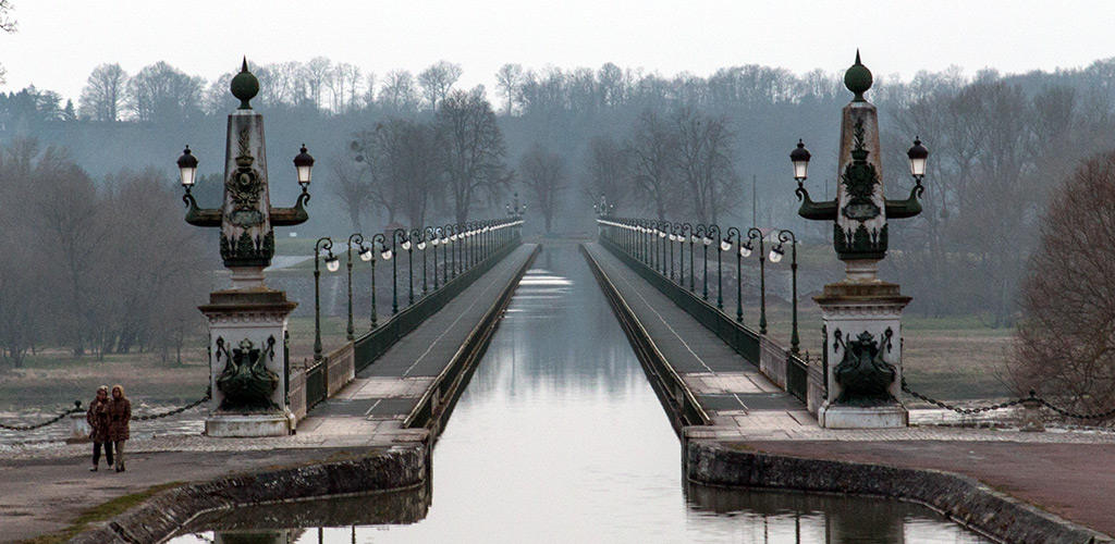
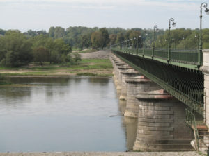
Another obstacle to French railway development was the powerful opposition to the changes that railways would bring. For example, in 1832, the Rouen Chamber of Commerce opposed a rail link between Rouen and Paris, arguing it would be detrimental to agriculture, hurt the traditional way of life, and impinge upon the business of the canals and rivers. This last argument emerged commonly throughout France. Unlike Russia or Germany, which had no well-developed canal systems, France had a great deal of capital invested in water-borne transport. These interests saw the railways as dangerous competition. The origins of this opposition stem from France’s geography. France was naturally endowed with many navigable waterways, and also with much terrain suitable for the construction of canals. Much of France also lies not far from the coast, and coastal shipping successfully and cheaply carried much trade. Thus, the interests which profited from canals, river, and coastal shipping all used their sway in government to limit the construction of railways. While other countries, such as Britain, already utilised canals and coastal shipping well, these nations had no government-controlled railways, and thus the vested interests of water-borne trade were less able to oppose new competition.

Catholic priests bless a railway engine in Calais, 1848

In France, existing interests combined with popular worries about the introduction of railways, especially concerning their safety. While those in opposition to railway development certainly remained a minority, their presence was larger in France than in most other industrialising nations. Since French rail development depended on government initiatives, French opponents had a clearer target to oppose than in countries where completely private companies constructed new railways.

The central involvement of government in French railways also slowed their construction, as it took time to forge a national railway policy. Under the July Monarchy, France became a far more democratic state than most others in Europe. While most of the numerous individual German states had strong central authorities, decisions in France needed to survive lengthy debates in parliament. France also exhibited considerable internal divisions within the state. Belgium, with its extremely unified political class just after independence (1830), could quickly embark on elaborate railway projects. France, however, remained long divided among liberals, conservatives, royalists and democrats, with laissez-faire liberals consistently holding a great deal of parliamentary power. All of the parties supported some form of governmental rail initiative, but they all had differing visions of the shape of that initiative. The parliament thus rejected all major rail projects before 1842, and during this period France steadily fell behind the nations that had reached quick consensus on railway policy.

The French rail system could not develop successfully without the involvement of the state. Unlike Great Britain or the United States, France had no large substantial industrial base willing to pay for railways to bring its products to new markets. French investment capital also lagged considerably behind the amounts available in Great Britain. Early troubles, such as the failed Paris to Rouen line, only reinforced the deep conservatism of the French banks. French private industry had not the strength to construct a railway industry unassisted by government. Thus, during the period of inaction by the government before 1842, the French built only small and scattered railway lines.

The eventual relationship created between the French rail system and the government formed a compromise between two competing options:

  1. the completely laissez-faire free-market system that had created Britain’s elaborate rail network
  2. a government-built and government-controlled railway, such as had grown up in Belgium.

France employed a mixture of these two models to construct its railways, but eventually turned definitively to the side of government control. The relationships between the government and private rail companies became complicated, with many conflicts and disagreements between the two groups.

Government intervention

Development of the network up to 1860

The 1842 agreement proved the most important piece of railway legislation. It aided the companies by having the department of the Ponts et Chaussées do most of the planning and engineering work for new lines. The government would assist in securing the land, often by expropriation. The government also agreed to pay infrastructure costs, building bridges, tunnels and track bed. The private companies would then furnish the tracks, stations and rolling stock, as well as pay the operating costs.

This general policy, masked many exceptions and additions. The most successful companies, especially the Compagnie du Nord, would often build their own lines themselves in order to avoid the complications of going through government. For instance, during the economic boom period of the 1850s, the national government had to pay only 19 percent of the costs of railway construction. Other less successful lines, such as the Midi, would often need more assistance from the government to remain in operation. The same proved true during recessions, such as in 1859, when the railway lines gained a new agreement to save them from bankruptcy. In exchange for funding part of the construction of rail lines, the French government set maximum rates that the companies could charge. It also insisted that all government traffic must travel at a third of standard costs.

The expectation that the government would eventually nationalise the rail system formed another important element in French railway legislation. The original agreement of 1842 leased the railway lines to the companies for only 36 years. Napoleon III extended these leases to 99 years soon after he came to power. That the rail companies only operated on leases paved the way for the nationalisation of the French rail lines under the socialist government of the 1930s.

The French rail policy, once put in place, had its deficiencies, but one certainly cannot consider it a failure, and other powers attempting to encourage rail developments adopted many aspects of the French railway laws. The bureaucratisation and influence of special interests associated with all governments, even those of corporations, also negatively affected the French railways. However, the French rail system had failed to grow on its own and required government intervention to expand successfully. While the alleged intrusion of government into the railway sector caused problems, it also proved necessary and inevitable.

Unlike in countries where the construction of railways became a field for private enterprise, the state constructed the bulk of the French railway system, and magnanimously invited private companies to operate the lines under leases (of up to 99 years). France’s railways form a somewhat unusual case in that they have never been privately owned. The state guaranteed the dividends of the railway operating companies, and in exchange took two-thirds of any greater profits.

The close relationship between the rail companies and government has much to do with French history. France had long had a large and elaborate bureaucracy and governmental structure that regulated many areas of French life. This bureaucracy survived the revolutionary period intact and played an important role in every government that ruled France in the nineteenth century. Thus, when railways arose, there already existed well-established governmental structures and procedures that could easily expand to encompass railway regulations as well. This regulatory régime, through the professional and powerful department of the Ponts et Chaussées, had very close control over the construction of roads, bridges and canals in France; therefore, it was inevitable that the new railways would also fall under the government’s close scrutiny.

Other reasons also led the French government to control its railways closely. Unlike the United Kingdom or the United States, France as a European continental power had pressing military/strategic needs from its railways, needs which a private sector might not provide. The French government constructed long stretches of strategic railways in eastern France along the German border that served strategically crucial ends, but lacked economic viability. “Pure” private economic interests would not have constructed these routes on their own, so France used government rewards and pressure to encourage the rail companies to build the needed lines. (The German and Russian Empires also had widespread strategic railway systems that private companies would not have built appropriately.)

The first completed lines radiated out of Paris, connecting France’s major cities to the capital. These lines still form the backbone of the French railway system. By the 1860s, workers had completed the basic structure of the network, but they continued to build many minor lines during the late 19th century to fill in the gaps .

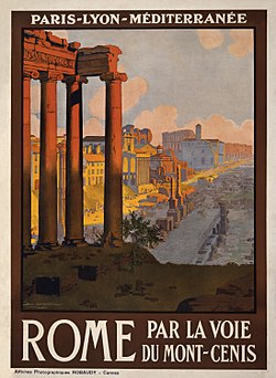
Government involvement in the railroads did mean that the French rail system became based on a very inefficient design. By 1855, the many original small firms had coalesced into six large companies, each having a regional monopoly in one area of France. The Nord, Est, Ouest, Paris-Orléans, Paris-Lyon-Méditerranée (PLM), and the Midi lines divided the nation into strict corridors of control. Difficulties arose in that the six large monopolies, with the exception of the Midi Company, all connected to Paris, but did not link together anywhere else in the country. The French railway map comprised a series of unconnected branches running out of Paris. While this meant that trains served Paris well, other parts of the country were not served as well. For instance, one branch of the Paris-Orléans Line ended in Clermont-Ferrand, while Lyon stood on the PLM Line. Thus any goods or passengers requiring transportation from Lyon to Clermont-Ferrand in 1860 needed to take a circuitous route via Paris of over seven hundred kilometers, even though a mere hundred and twenty kilometers separated the two cities.

This grave inefficiency lead to great problems in the Franco-Prussian War (1870 – 1871). The German railway lines, inter-connected in a grid-like fashion, proved far more efficient at advancing troops and supplies to the front than the French one. “Combien nous a été funeste l’absence de lignes transversales […] unissant nos grandes artères” reported a military officer to the parliamentary inquiry on France’s defeat.

The arrangement of the lines also hurt France’s economy. Shipping costs between regional centres became greatly inflated. Thus many cities specialised in exporting their goods to Paris, as trans-shipment to a second city would double the price.

France ended up with this regressive arrangement for a number of reasons. Paris formed the undisputed capital of France, and many viewed it as the capital of Europe. To French railway planners, it seemed only natural that all the lines should involve the metropolis. By contrast Germany ended up with a far superior system because it had little unity and many centers vying for preeminence. Thus a variety of rail centres arose. Berlin, Munich, Dresden, Hamburg, and the Rhine areas all had links to each other.

The French railway lines also exhibited a high degree of centralisation because plans dictated this. Unlike Britain and America, France had a central government which greatly influenced the layout and the planning of the railways. This Paris-centric government had minimal local representation, especially in the bureaucracy. The Ponts et Chaussées department that supervised the railways remained thoroughly Parisian. Because of strong governmental and administrative influence, all six of the French railway companies had their headquarters in Paris. This occurred not only because of the unquestioned centrality of Paris, but also because the rail companies always remained in close contact with the French government, and needed bases in Paris to ensure positive relations.

Nineteenth-century Britain largely lacked intensive government interference in the railways. Railway companies thus experienced less pressure to centre their lines on London, and also less necessity for each company to cultivate such close links to the centre of political power. In England, for instance, local businesses financed and promoted the Stockton & Darlington and Liverpool & Manchester lines. In France, cities like Lyon and Bordeaux did not have many wealthy investors – capital emanated almost exclusively from Paris. This concentration of capital in Paris also contributed to the concentration of the railway system in the metropolis.

The most important of the railway operating companies during this period included:

By 1914 the French railway system had become one of the densest and most highly developed in the world, and had reached its maximum extent of around 60,000 km (37,000 mi). About one third of this mileage comprised narrow gauge lines.

Following the First World War, France received significant additions to its locomotive and wagon fleet as part of the reparations from Germany required by the Versailles Treaty. In addition the network of the Imperial Railways in Alsace-Lorraine was taken over by France when the Alsace-Lorraine region, which had been under German control since the Franco-Prussian War, was returned to France.

Nationalisation

By the 1930s, road competition began to take its toll on the railways, and the rail network needed pruning. The narrow gauge lines suffered most severely from road competition; many thousands of miles of narrow gauge lines closed during the 1930s. By the 1950s the once extensive narrow gauge system had practically become extinct. Many minor standard gauge lines also closed. The French railway system today has around 40,000 km (25,000 mi) of track.

Many of the private railway operating companies began to face financial difficulties. In 1938 the socialist government fully nationalised the railway system and formed the Société Nationale des Chemins de fer Francais (SNCF). Regional authorities have begun to specify schedules since the mid of the 1970s with general conventions between the regions and the SNCF since the mid-1980s.

From 1981 onwards, a newly constructed set of high-speed TGV (Train à Grande Vitesse) lines linked France’s most populated areas with the capital, starting with Paris-Lyon. In 1994, the Channel Tunnel opened, connecting France and Great Britain by rail under the English Channel.

See also

References

  • Caron, François. Histoire des Chemins de Fer en France. Paris: Fayard, 1997.
  • Clapham, J. H. The Economic Development of France and Germany, 1815-1914. Cambridge University Press, 1961.
  • Doukas, Kimon A. The French Railroads and the State. Columbia University Press, 1945.
  • Dunham, Arthur. “How the First French Railways Were Planned.” Journal of Economic History. Vol. 1, No. 1. (1941), pp. 12–25 in JSTOR
  • Lefranc, Georges. “The French Railroads, 1823-1842”, Journal of Business and Economic History, II, 1929–30, 299-331.
  • Mitchell, Allan. The Great Train Race: Railways and the Franco-German Rivalry, 1815-1914. Berghahn Books, 2000.
  • Sterne, Simon. “Some Curious Phases of the Railway Question in Europe.” The Quarterly Journal of Economics, Vol. 1, No. 4. (1887), pp. 453–468. in JSTOR

Châtelet (Paris Métro)

Wikipedia

Ligne-14-Chatelet-1.jpg


Pl. du Châtelet
1st arrondissement of Paris
Île-de-France
France


Châtelet is a station on lines 1, 4, 7, 11 and 14 of the Paris Métro in the centre of medieval Paris and the 1st arrondissement. The station is made up of two parts connected by a long corridor:

Châtelet is connected by another long underground corridor to the southern end of the RER station Châtelet – Les Halles, the northern end of which is again connected to the Métro station Les Halles. The distance from Line 7 at Châtelet to the RER lines at Châtelet – Les Halles is approximately 750 metres (2,460 ft). It is the ninth-busiest station on the Metro system.

History

The station was opened on 6 August 1900, three weeks after trains began running on the original section of line 1 between Porte de Vincennes and Porte Maillot on 19 July 1900. The line 4 platforms were opened on 21 April 1908 as part of the original section of the line from Porte de Clignancourt to Châtelet. It was the southern terminus of line 4 until the opening of the connecting section of the line under the Seine to Raspail on 9 January 1910.

The line 7 platforms were opened on 16 April 1926 as part of the line’s extension from Palais Royal to Pont Marie with the name Pont Notre-Dame-Pont au Change. It had no direct connection with Châtelet. On 15 April 1934 a connecting corridor was opened to the platforms of lines 1 and 4 and the line 7 station was renamed. The line 11 platforms were opened near the line 7 platforms on 28 April 1935 as part of the original section of the line from Châtelet to Porte des Lilas.

On 9 December 1977 the Châtelet – Les Halles RER station was opened with a connecting corridor with a moving walkway to Châtelet. The line 14 platforms were opened near the line 1 and 4 platforms on 15 October 1998 as part of the original section of the line from Madeleine to Bibliothèque François Mitterrand. On 7 and 8 March 2009 the line 1 platforms were restored during the automation of line 1, including the installation of platform screen doors.

It is named after the Place du Châtelet, which is named after the Grand Châtelet, a castle over the northern approach to the old Pont au Change over the Seine to the Île de la Cité, which was demolished by Napoléon in 1802. Châtelet is a medieval French term for barbican, a small castle that commands (overlooks) a bridge or defile.[1]

Station layout

G Street Level Exit/Entrance
B1 Mezzanine to Exits/Entrances
Line 1 platforms (B2) Side platform with PSDs, doors will open on the right
Platform 1 Paris Métro Paris Métro Line 1 toward La Défense – Grande Arche (Louvre – Rivoli)
Platform 2 Paris Métro Paris Métro Line 1 toward Château de Vincennes (Hôtel de Ville) →
Side platform with PSDs, doors will open on the right
Line 7 platforms (B2) Side platform, doors will open on the right
Platform 2 Paris Métro Paris Métro Line 7 toward Villejuif – Louis Aragon or Mairie d’Ivry (Pont Marie)
Platform 1 Paris Métro Paris Métro Line 7 toward La Courneuve – 8 Mai 1945 (Pont Neuf) →
Side platform, doors will open on the right
Line 11 platforms (B3) Side platform, doors will open on the right
Platform 1 Paris Métro Paris Métro Line 11 Alighting passengers only
Platform 2 Paris Métro Paris Métro Line 11 toward Mairie des Lilas (Hôtel de Ville) →
Island platform, doors will open on the left, right
Platform 4 Paris Métro Paris Métro Line 11 toward Mairie des Lilas (Hôtel de Ville) →
Line 4 platforms (B4) Side platform, doors will open on the right
Platform 2 Paris Métro Paris Métro Line 4 toward Porte de Clignancourt (Les Halles)
Platform 1 Paris Métro Paris Métro Line 4 toward Mairie de Montrouge (Cité) →
Side platform, doors will open on the right
Line 14 platforms (B6) Side platform with PSDs, doors will open on the right
Platform 2 Paris Métro Paris Métro Line 14 toward Saint-Lazare (Pyramides)
Platform 1 Paris Métro Paris Métro Line 14 toward Olympiades (Gare de Lyon)
Side platform with PSDs, doors will open on the right

Gallery

See also

References

Roland, Gérard (2003). Stations de métro: D’Abbesses à Wagram. Éditions Bonneton.

Notes

Jacques Hillairet, Dictionnaire historique des rues de Paris, 8th ed. (Éditions de Minuit, 1985), Vol. 1, pp. 331–34.


Briare Canal


The Loiret can pride itself on possessing one of the most exceptional works of art in existence. Constructed between 1890 and 1896, this metal canal bridge spans the Loire in a giant stride to connect the Canal Latéral à la Loire with the Canal de Briare. Bordered by 72 lamposts and magnificent pillars adorned with coats of arms at either end, the bridge encapsulates the aptitude of man’s skill with iron and stone without sacrificing aesthetics. While its monumental beauty is revealed under a blue sky, its charm is revealed when the water mirror dispapears in the morning mist which rises above the river…


Waterways – Canal du Midi


The Canal du Midi


The Midi Canal, otherwise known as the Languedoc Canal, begins its 240 km journey in Toulouse, rising 60 metres over 26 locks, cruising along its 5 km summit then dropping 190 metres over 180 km with 74 locks to meet the Mediterranean Sea at Sète.

The following is a brief history with maps and is provided by french-waterways.com

It was the Romans who first had the idea of building a waterway to join the Atlantic and the Mediterranean, but the task proved impossible for many practical reasons. Even the great Leonardo da Vinci was unable to contemplate the task. In fact, it wasn’t until 1667 that construction actually began, under the reign of Louis XIV. Pierre-Paul Riquet designed and built the Canal Royal de Languedoc (as it was then known) with the aim of transporting wheat, wine and textiles. It took 12,000 people (surprisingly for this period, it was women who made up a large part of the workforce) to make it a reality, but it opened on May 15th 1681. However, it wasn’t until two centuries later, when his canal was linked to the Canal du Garonne, that Riquet’s dream of reaching the Atlantic was fulfilled.

Canal du Midi map

The Canal Royal de Languedoc was renamed the Canal du Midi during the French Revolution, and by 1856 it carried over 100,000 tonnes of cargo and a million passengers a year. However, by the following year commerce had almost dried up due to the opening of the Bordeaux to Sete railway.

The combination of stunning scenery, wide variety of nature, avenue of trees and of course the sheer engineering prowess and unique locks that run the length of the canal, have given the Canal du Midi a renaissance. Since the 1990s tourists have flocked to the world renowned stretch of water and its popularity continues to grow.

To ensure the future appearance of the Canal du Midi, a huge replanting operation is currently underway, with thousands of new trees being planted to preserve the character of the canal for years to come.

Canal du Midi map


.