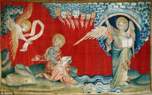
Apocalypse Tapestry, Angers, Jean Bondol and Nicholas Bataille, 1377 – 1382
Britannica
Angers, city, capital of Maine-et-Loire département, Pays de la Loire région, western France. Angers is the former capital of Anjou and lies along the Maine River 5 miles (8 km) above the latter’s junction with the Loire River, northeast of Nantes. The old city is on the river’s left bank, with three bridges crossing to Doutre.

Capital of the Andecavi, a Gallic tribe of the state of Andes, the ancient town became Juliomagus under the Romans. The succession of counts of Anjou began in the 9th century, and the rule of the Plantagenets was marked in Angers by the construction of magnificent monuments, of which the French Hôpital Saint-Jean (now housing an archaeological museum) is the most striking. The city’s massive, moated château, whose 17 towers are from 130 to 190 feet (40 to 58 metres) high, was built in 1230 on the site of earlier castles; it houses the late 14th-century Apocalypse series of tapestries (woven by Nicholas Bataille). Despite the damage of past wars, particularly World War II, Angers is still rich in medieval architecture. The 12th–13th-century cathedral of Saint-Maurice retains its original stained glass. The 15th-century Barrault House contains the public library, an art museum, and the complete works of the sculptor Pierre-Jean-David d’Angers, who was born in the city. The prefecture is in the former Saint-Aubin Abbey (11th century), which has Roman arcades. The medieval Universitas Andegavensis was refounded in 1876 as the Catholic Faculty of the West.

The city’s traditional industries such as slate quarrying, distilling, rope and cable manufacture, and weaving have been supplemented by electronics, photographic equipment, and elevators. Pop. (1999) 151,279; (2014 est.) 151,056.
From BnF, France Archives – New Plan of the City of Angers
Enriched with the Map of the Surroundings and the Perspective of the City With its Principal Houses Raised by the care of the Mayors and Aldermen and Perpetual Councilors of the Town Hall brought to light in 1736